Picture your morning two ways: stepping onto a private dock for a quick paddle before work, or sipping coffee as the skyline and Hill Country stretch out below. If you are weighing waterfront versus hillside living in Westlake’s 78746, both options deliver a standout lifestyle. The everyday details are very different, though. This guide walks you through lot types, permits, docks, flood and geology, maintenance, commutes and due diligence so you can choose with confidence. Let’s dive in.
Westlake at a glance
Most of 78746 sits within West Lake Hills, Rollingwood, and nearby West Austin pockets. Jurisdiction can shift within the same ZIP, so permitting and utilities depend on whether a home is in the City of West Lake Hills, the Town of Rollingwood, the City of Austin, or unincorporated Travis County. You can start with the City of West Lake Hills site to understand local services, then confirm the exact authority for any specific address.
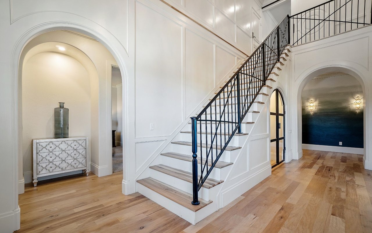
This ZIP is one of Austin’s highest value residential areas. Recent local reporting shows median prices in Westlake reaching the multi-million range in 2025, with month-to-month variation by subarea and property type. For context, Community Impact reported a $2.4 million median in March 2025. Use address-level MLS data for current accuracy when you are ready to compare homes.
Waterfront on Lake Austin
Lot feel and layout
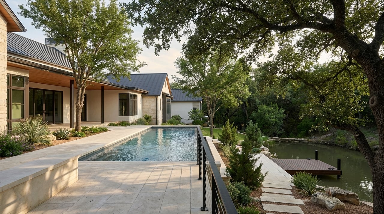
Lake-edge parcels often pair big backyards with relatively narrow shoreline frontage. Many have engineered edges like bulkheads. You gain immediate access to the water, tree canopy, and long greenbelt views along the river-like lake.
Docks, permits and who to call
If a private dock is part of your plan, know the roles upfront:
- On Lake Austin, the City of Austin administers residential boat docks. Start with the city’s Boat Docks guidance to understand permits, registration and safety requirements.
- The Lower Colorado River Authority provides lake-wide rules for the Highland Lakes. Their docks and marinas page is a good reference for lake use and encumbrances.
- The Austin Land Development Code Article 13 sets parcel-specific limits that often apply, including maximum dock footprint, width relative to shoreline, and the number of motorboats stored. You can review a representative section here: §25-2-1176.
Rules can vary by address and jurisdiction. Some parcels qualify for a site plan exemption, others need a full site plan or even variances. Plan for lead time to verify what is already permitted and what is possible.
Public access if you do not have a dock
Many Westlake owners love the water but choose hillside or off-water homes. In that case, Lake Austin boat launches and parks provide access for boating and fishing. Popular options include Walsh Boat Landing, the Loop 360 ramp near Pennybacker Bridge, Emma Long Metropolitan Park, and Mary Quinlan Park. See the Texas Parks and Wildlife access list for details and seasonal notes.
Everyday life, maintenance and risk
Waterfront living shines for instant recreation and evenings on the water. Tradeoffs include weekend boat traffic in busy stretches and dock upkeep. Docks and bulkheads require periodic inspection, repair and eventual replacement. Many lake-edge ground floors sit close to the water surface, so flood exposure can be a factor.
- Flood risk and insurance: Confirm your exact risk before you buy. Start with FEMA’s official maps at the Flood Map Service Center and request an Elevation Certificate if the seller does not have one. Under FEMA’s Risk Rating 2.0, premiums are property specific, so the certificate and site details matter.
- Ownership and restrictions: Verify whether the seller owns the submerged land in front of the lot, the right to install or maintain a dock, and any HOA or deed restrictions on waterfront use. LCRA guidance and City of Austin staff contacts are the best starting points for these checks.
Hillside and elevated-view homes
Lot character and topography
Hillside properties in Westlake sit on the Balcones Escarpment with classic Hill Country geology. Expect limestone rimrock, steep slopes, and canyons that produce some of the area’s most dramatic vistas. If you want panoramic views of the lake, canyons or downtown, this setting delivers. Learn more about the area’s geology through the UT Bureau of Economic Geology.
Environmental and permitting considerations
Some hillside parcels lie over the Edwards Aquifer recharge zone or include critical environmental features like rimrock, bluffs or springs. When those features are present, the city may require an Environmental Resource Inventory, hydrogeologic or karst surveys, and a geotechnical report as part of site plan review. Public permitting packets provide useful examples of the studies and mitigation plans commonly requested, such as this zoning and platting case with environmental documentation.
Building and utilities in practice
Steeper, view-oriented sites often need specialized foundations, deep piers, engineered retaining walls, and careful erosion controls. Those add cost and time but also produce striking architecture that steps with the land. Depending on the exact location, some parcels may still use on-site sewage systems, while others tie into municipal service. Rollingwood provides a helpful starting point for service setup on its city utility services page. Confirm the specific provider and connection options for the parcel you are considering.
Everyday life and maintenance
Hillside living prioritizes privacy, elevation and quiet. You trade dock maintenance for driveway and drainage care, and you may have multilevel stairs or an elevator to reach the best views. Plan for longer permitting timelines if environmental features or steep-slope rules apply.
Commute and neighborhood lifestyle
Westlake is close to downtown by mileage, but drive times hinge on your route and peak traffic along MoPac and Loop 360. Always test your exact commute during rush hours. Rollingwood feels compact and close to parks and the western approach to Zilker and Barton Springs. West Lake Hills tends to favor larger lots, greater separation, and proximity to Wild Basin preserves and dining along Bee Caves and Westlake Drive. Map your daily routine, then test those routes at the times you will actually drive them.
Waterfront vs hillside: quick guide
Waterfront strengths
- Step-to-the-water lifestyle for boating, paddling and fishing
- Private dock potential when permitted
- Greenbelt-like views along Lake Austin
Waterfront tradeoffs
- Dock ownership, registration and maintenance costs
- Weekend activity and noise in popular stretches
- Flood exposure near the shoreline and higher insurance diligence
Hillside strengths
- Elevated privacy and panoramic views
- Reduced boat noise and more separation from neighbors
- Cooler breezes and dramatic architecture that fits the slope
Hillside tradeoffs
- Steeper driveways and multilevel living for view access
- Geotechnical and environmental studies that can extend timelines
- Engineered retaining, drainage and erosion controls that add cost
Two real-world scenarios
Lake-edge, narrow-frontage lot
- What you get: Morning swim or paddle, potential for a private dock, and a lawn that meets the water.
- What to confirm: Does the parcel fall under City of Austin dock rules, and what is already permitted? Start with Boat Docks guidance and the Article 13 code section on docks. Verify submerged-land rights and any LCRA encumbrances using LCRA’s docks and marinas page. Pull the FEMA map and an Elevation Certificate from the FEMA MSC.
Wild Basin ridge parcel with rimrock
- What you get: Broad views, privacy and a setting that calls for a stepped, design-forward build.
- What to confirm: Whether the lot lies over the Edwards recharge zone or includes critical features that trigger an Environmental Resource Inventory, hydrogeologic or karst surveys, and geotechnical engineering. Review a public case example of these requirements in action here. Expect erosion controls, tree protection and site restoration measures during construction.
Buyer checklist for 78746
Use this list to ask the right questions at showings and during option periods.
- Flood and elevation
- Pull the FEMA map and request an Elevation Certificate. Start at the FEMA Flood Map Service Center.
- Dock rights and records (waterfront)
- Confirm submerged-land ownership and whether any LCRA rights or easements affect your dock plan. Reference LCRA’s guidance.
- Ask for existing City of Austin dock permits, registration, addressing and maintenance records. Review the city’s Boat Docks page and relevant code section.
- Environmental and geotechnical (hillside)
- Order a geotechnical report and verify whether the site has rimrock, bluffs, springs or other critical features. Public packets like this example show typical environmental documentation.
- Permitting history and timing
- Request prior site plans, variances, erosion and tree protection plans. These reveal likely conditions and timelines.
- Utilities
- Confirm water, wastewater or on-site sewage for the address and how to initiate service. Rollingwood’s utility services page is a useful starting point for parcels in that jurisdiction.
- Insurance and operating costs
- Gather quotes for flood insurance and estimates for dock upkeep or hillside retaining and drainage work.
Which one fits you best?
If you picture life on the water with daily boat time and guests arriving at your dock, a Lake Austin shoreline home puts that dream front and center. Build in time for dock due diligence, flood mapping and maintenance planning. If you want quiet mornings, dramatic sunsets and a sense of retreat, a hillside property offers privacy and views worth the engineering. Plan for geotech, environmental review and a builder who thrives on complex sites.
Either way, the right plan starts with jurisdiction and site specifics, not just the neighborhood name. When you are ready for a tailored search and a clear due diligence roadmap in 78746, connect with Gay Puckett to compare options and move forward with confidence.
FAQs
What permits do I need for a private dock on Lake Austin?
- Residential docks are administered by the City of Austin. Many projects need a site plan or exemption plus a building permit, and must meet Article 13 limits on size and boat counts. Start with the city’s Boat Docks guidance and review §25-2-1176.
How do I check flood risk for a Westlake property?
- Search the address at FEMA’s Flood Map Service Center and obtain an Elevation Certificate to estimate insurance under Risk Rating 2.0.
Who regulates docks and lake use on Lake Austin?
- The City of Austin regulates residential docks, while the Lower Colorado River Authority provides broader Highland Lakes guidance and manages certain lakebed encumbrances.
What environmental studies are common for hillside builds in 78746?
- Depending on site features, you may need an Environmental Resource Inventory, hydrogeologic or karst surveys, a geotechnical report, and enhanced erosion and tree protection plans. See a public case example here.
Are hillside lots in Westlake always on septic?
- Not always. Service depends on the exact location and provider. Confirm with the relevant jurisdiction and utility. Rollingwood outlines setup steps on its utility services page.
Where can I launch a boat if I buy a hillside home without a dock?
- Public access options include Walsh Boat Landing, Loop 360 ramp, Emma Long Metropolitan Park and Mary Quinlan Park. See the TPWD Lake Austin access page for locations and details.